Blue Marble Terrain (BMT) Uploaded
 Starting in 2001 NASA began releasing public, detailed imagery allowing modelers to recreate the Earth in high resolution. The project was dubbed Blue Marble in reference to Earth’s appearance from space. This set represents an attempt to bring that imagery to Empire Deluxe through a full enhancement of the original terrain graphics. It is available for download on EDIBLE or at the bottom of this post.
This set modifies fourteen of the original terrain files and replaces them with real satellite imagery taken from the MODIS and VIIRS imaging satellites orbiting at 750km to 850km above the earth. A painstaking amount of effort was made to keep the images as close to their unaltered form with as few modifications as possible.
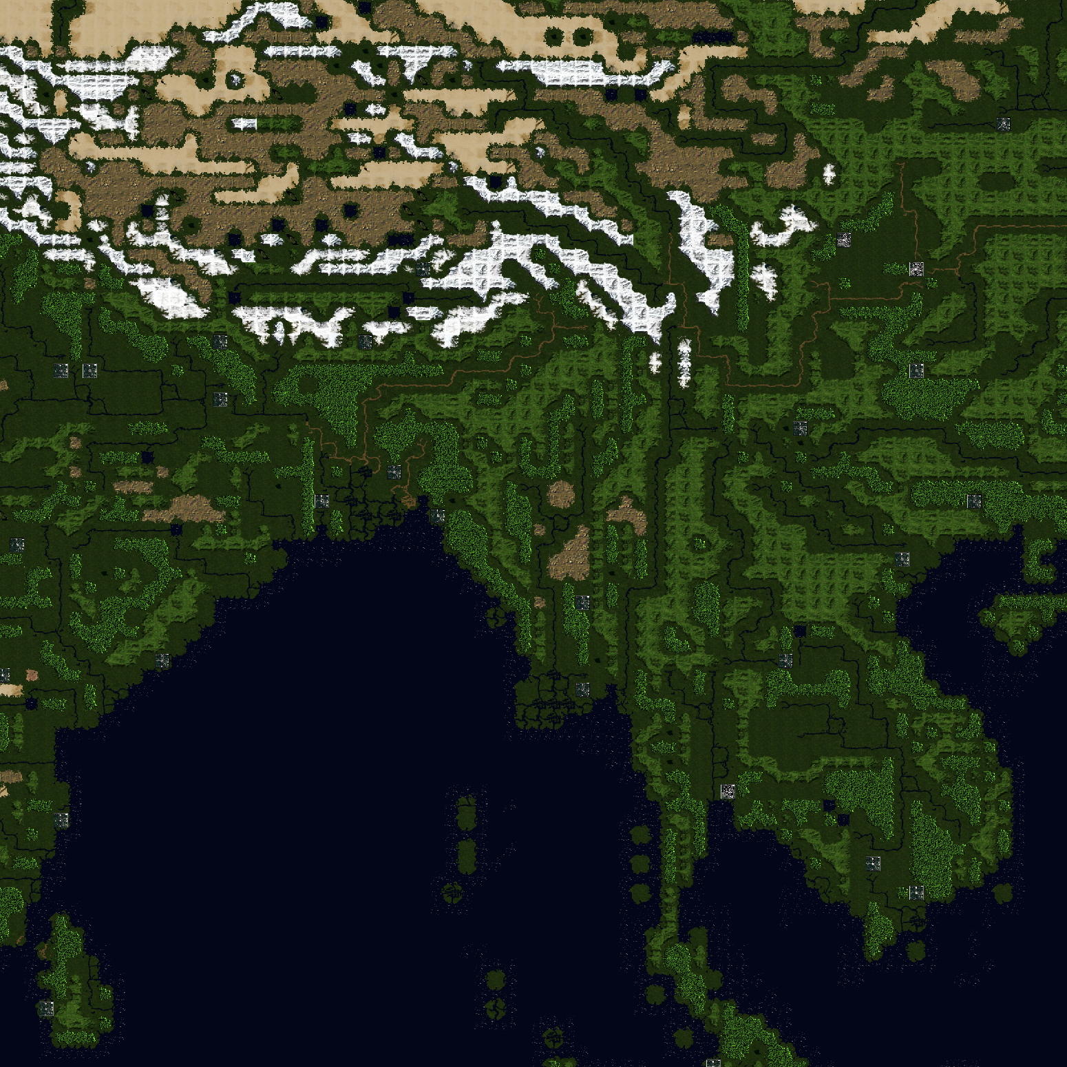
The Blue Marble Terrain set takes satellite photography from various places on Earth and converts them into 32×32 tiles. The objective is to create a visual experience that, when viewed from the player’s perspective, makes your map look as close as possible to the view of that map you would get if you were in orbit. Here are several highlights about this set.
Recreating The Earth
I chose to standardize all tiles at 32×32 and image resolution of 1 km per pixel. That means a 10 x 10 map is 320km x 320km if you are into that kind of thing. The images used to create these tiles were taken from the EOS satellite imaging hardware in close orbit around Earth at a range between 750km to 850km.
True Color Replication
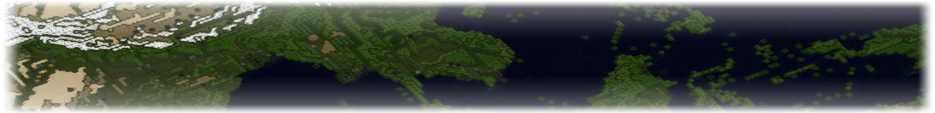
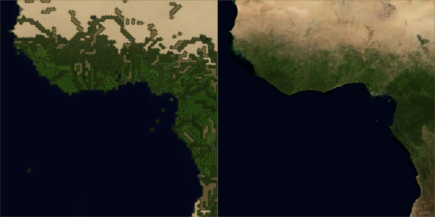
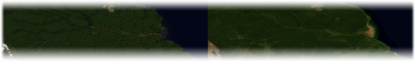
You can now create Earth maps that will match the true color of Earth. This includes a lot of darker toned vegetation, deeper blues in the ocean, and higher contrast between whites, browns, and greens. Here you can see a side-by-side render of a cloudless Earth compared to a map made in Empire Deluxe of the same scale.
Better Rivers
Rivers are no longer bland straight valleys of water. They curve and warp according to the terrain around them. This is due to a combination of two data sets merged into one that helps map the true look and feel of waterways found on Earth. MODIS satellite imagery makes the base terrain with VIIRS images superimposed using multiple waterway bands. In other words, the realistic course of the rivers is due to the images coming from actual waterways here on Earth.
High Contrast Hills and Forest
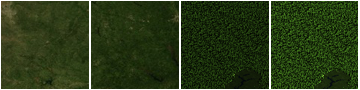
The only modification made manually are a nominal contrast increase in hills and forests. If you look at the images here you can see why. The color difference was nominal, under 2%, between similar terrain sets. While this works fine on my computer, older monitors, namely most LCD’s and some LED monitors, cannot discern the difference. I opted to improve contrast to help them stand out on higher resolutions or when the map is zoomed further out. Other than the contrast, the tiles are real world images taken from Siberia and Germany. See if you can locate exactly where.

Topography Diversification
I intentionally wanted to diversify the topography of this set to allow unique terrain combinations. This allows for maps to take on their own flavor beyond just the game mechanics. It will take some time to get used to, but once your eyes have adjusted to the new style, it’s hard to go back.
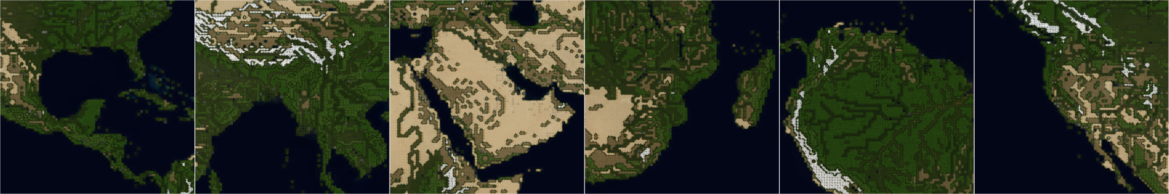
The biggest example of this is the use of green mountains instead of the more traditional gray color. This more accurately represents the span of vegetation on mountainsides, leaving peaks to handle the heavy lifting of lifeless mountain tops. There is also a distinct difference where hills have a more Arid appearance, allowing an alternative option to just having green land as the only non-mountain terrain tile. Lastly, there are coastal tiles which now use white caps, captured from orbital imagery, to enhance the tiles while keeping their true color as seen from space.
Realistic Maps
Regardless of your preference for playing Earth maps, the tile set has been blended together to provide a good experience across all map types. This includes random maps, scenario maps, or even your own personal fictional map. The set is also made to work with all of the terrain-based uploads on EDIBLE I have made so far, including the city tile set RUCS which is used in the screenshots in this update.
One Comment